
Understanding Drone Forensics: Securing the Skies & Borders Through Digital Investigation
- Dimpal
- Aug 5, 2025
- 5 min read
Updated: Aug 6, 2025
In the modern digital age, the proliferation of unmanned aerial vehicles (UAVs), more commonly referred to as drones, has opened up exciting new possibilities across numerous fields—from logistics and agriculture to filmmaking, surveillance, and even emergency response.
However, as with any technological advancement, the widespread adoption of drones has also introduced new security threats and legal challenges. Drones are no longer limited to civilian recreational use; they have been co-opted by malicious actors for smuggling, spying, disruption of public events, and even terrorist activities. In response to this growing threat, the field of drone forensics has emerged as a crucial discipline within digital forensics, tasked with analyzing and interpreting digital evidence from UAVs involved in suspected criminal or unauthorized activity.
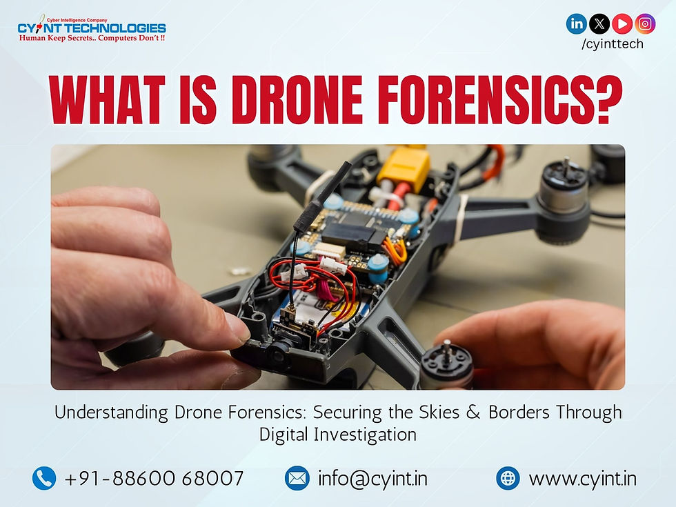
Drone forensics is concerned with the identification, preservation, extraction, analysis, and presentation of data obtained from drones and their associated control systems. This branch of forensics aims to answer critical questions in an investigation, such as where the drone came from, who operated it, what its intended mission was, and whether it was involved in any criminal act. Investigators typically examine both the physical drone hardware and its internal storage systems, including memory cards, flight control logs, and even the software or firmware that operates the device. Additionally, associated components such as mobile phones, tablets, or laptops that function as the drone's ground control system (GCS) can be forensically analyzed for a more comprehensive view of how the UAV was used.
The investigative process involves several complex steps. The first is identification—knowing what kind of drone has been recovered, including the make, model, and potential data sources within it. Following that, preservation involves ensuring that digital evidence is not tampered with or erased, particularly in cases where drones may be programmed to delete flight logs or data after a crash. The next step, data acquisition, requires tools and techniques to safely extract flight logs, media, GPS coordinates, and other stored metadata from the drone's internal memory. Often, drones also store data on cloud services via synchronized accounts, making the investigation more challenging as it may require obtaining legal access to third-party servers.

Once the data is extracted, forensic analysts begin the process of decoding and interpreting the information. By analyzing GPS logs, timestamps, flight parameters, and onboard images or videos, investigators can often reconstruct the drone’s entire mission path. Such reconstruction can reveal if a drone crossed restricted airspace, hovered over sensitive installations, or captured unauthorized surveillance footage. Moreover, metadata embedded within image and video files, such as EXIF data, can also provide crucial contextual evidence linking the UAV to a specific geographic location and time. In some cases, mobile devices used to control the drones may retain cached data, account credentials, and operational logs that can further strengthen the chain of evidence.
Despite these capabilities, drone forensics remains a technically demanding and evolving field. One of the primary challenges is the rapid evolution of drone technology. Manufacturers frequently update hardware and firmware, introducing proprietary formats and encryption methods that render traditional forensic tools ineffective. In addition, some commercial drones are equipped with anti-forensic capabilities such as encrypted flight logs or auto-wipe mechanisms designed to erase critical data when tampered with. The lack of standardized procedures and certified forensic tools also makes it difficult to ensure consistency and legality in investigations. Without unified frameworks, investigators are often left relying on ad hoc solutions, risking incomplete data recovery or the inadvertent destruction of evidence.
To address these challenges, forensic investigators use advanced tools and modular software platforms like MD Drone from GMDSoft, CFID from SCG Canada & MSAB XRY (XRY Drone) which capable of acquiring and analyzing data from a wide range of drone models and their related ecosystems. These solutions extract flight logs, media files, system configurations, and even deleted files from both the drone’s internal storage and connected devices. One of the most significant advantages of such tools lies in their ability to decode and visualize flight paths, GPS traces, and telemetry data on detailed maps. This geospatial representation enables investigators to pinpoint launch and landing zones, trace aerial routes, and determine proximity to sensitive locations.

Moreover, modern forensic platforms allow the correlation of data between drones and their ground control systems. By analyzing data stored on smartphones, tablets, or remote controllers used to operate UAVs, analysts can often link the drone to specific users or accounts. This capability is especially critical when investigating ownership, operational intent, or potential criminal use behind a drone’s deployment. The ability to cross-reference drone logs with user data from companion apps and cloud services adds an additional layer of evidentiary strength to forensic findings.
Importantly, today’s forensic workflows also include support for decrypting flight logs from both commercial drones and DIY (do-it-yourself) drone platforms. These systems ensure that encrypted telemetry and navigation data can be accessed and interpreted regardless of the drone’s make or origin—an increasingly necessary capability given the rise of home-built or modified UAVs used in various illicit activities.
Another key aspect of the forensic process is automated report generation. Investigators can export findings in structured, court-admissible formats that include visual elements such as flight path overlays, metadata summaries, and timeline reconstructions. These reports are designed to meet international standards for legal documentation, ensuring that evidence can withstand scrutiny in judicial proceedings. Multilingual interfaces and adherence to chain-of-custody protocols also enhance the usability of such tools in cross-border or multinational investigations.

Although drone forensics was not actively deployed during the recent war with the neighbouring country, the discipline is highly applicable to such conflict scenarios. The war saw extensive use of drones for reconnaissance, targeting, and tactical strikes, with both military-grade and modified commercial UAVs being utilized on the frontlines. In such environments, forensic tools could play a vital role in post-incident investigations and intelligence gathering. If enemy drones are recovered, investigators can extract flight paths, identify launch coordinates, and analyze onboard data to determine operational patterns or control sources. Forensic analysis can also help detect firmware alterations, assess payload modifications, and retrieve captured imagery or communications. These insights are invaluable for attributing attacks, understanding tactics, and developing strategic countermeasures.
Looking forward, the need for reliable and advanced drone forensic capabilities is only expected to grow. With the advent of autonomous drones, swarm-based UAV systems, and long-range encrypted communication protocols, forensic investigators will face new challenges that go beyond traditional data recovery. The future of drone forensics will involve integrating machine learning to analyze behavioral data, developing AI models to predict UAV missions, and expanding capabilities to analyze collaborative drone operations in real time.
In conclusion, as drone technology continues to reshape the modern world—from civilian skies to critical defence operations—drone forensics is no longer optional; it is a strategic necessity. This emerging discipline offers the tools and techniques needed to unravel aerial threats, trace accountability, and reinforce digital and physical borders alike. Through the integration of advanced forensic tools like MD Drone, CFID, and XRY Drone, investigators can move beyond reactive analysis and toward proactive aerial intelligence. But tools alone are not enough. It takes trained experts, cross-sector collaboration, and forward-looking strategy to truly secure the skies.
At Cyint, we are actively contributing to this evolving domain. If your organization is exploring drone forensics or preparing for aerial threat response, we welcome the opportunity to collaborate, advise, or support your mission. The skies are changing — and readiness starts now.

